Why a Desert Is Not Just Hot Sand: Teaching Arid Climates Through Physical Evidence
Ask an elementary student to picture a desert, and they will almost certainly describe endless rolling hills of yellow sand under a scorching tropical sun. Introducing young learners to a thoughtfully designed deserts workbook for kids is the most effective way to challenge that visual bias with genuine climatology. By treating aridity as a measurable physical condition rather than a temperature setting, this comprehensive deserts workbook for kids guides children to discover that a desert is defined by a lack of rain or snow, not by blistering heat or sand dunes.
Standard elementary worksheets often reinforce the common «sand trap». They hand students cartoon drawings of dunes, cacti, and lizards, leaving them with the persistent misconception that any dry place must be intensely hot, and that a sunny coastline with golden beaches is practically an arid biome. In scientific meteorology, however, looks and thermometer readings can be misleading: a region is generally classified as a desert if it averages less than 250 millimeters (10 inches) of precipitation per year.
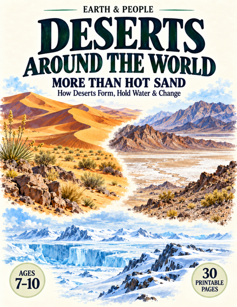
In Earth & People: Deserts Around the World — More Than Hot Sand (a 30-page printable workbook designed for ages 7–10), young geographers approach arid regions through five distinct analytical lenses: Dryness (how much falls), Cause (why so little), Surface (what covers the ground), Water (where water hides), and Change (how landscapes transform over time).

Escaping the Sand Trap Through Climate Data
Real scientific inquiry begins when children learn to test assumptions against long-term data rather than surface appearances.
On the «Sand Trap» spread, students evaluate four contrasting model environments:
- Rocky Basin: 70 mm of precipitation per year.
- Hot Rainforest: 1,800 mm of precipitation per year.
- Sunny Sand Coast: 1,200 mm of precipitation per year.
- Icy Plateau: 50 mm of precipitation per year (measured as melted water equivalent).
Children circle the locations that receive less than 250 mm of annual moisture, discovering two major surprises: a sand-covered tropical beach is not an arid biome, and the frigid interior plateau of Antarctica is actually the driest environment on the list.
This stark contrast between biomes highlights how water availability dictates ecological systems. While lush equatorial jungles cycle massive quantities of water through rapid atmospheric transpiration—a closed-loop dynamic explored in our guide to the Tropical Rainforest Workbook—arid lands must function under extreme water limits, where every millimeter of moisture alters the terrain.
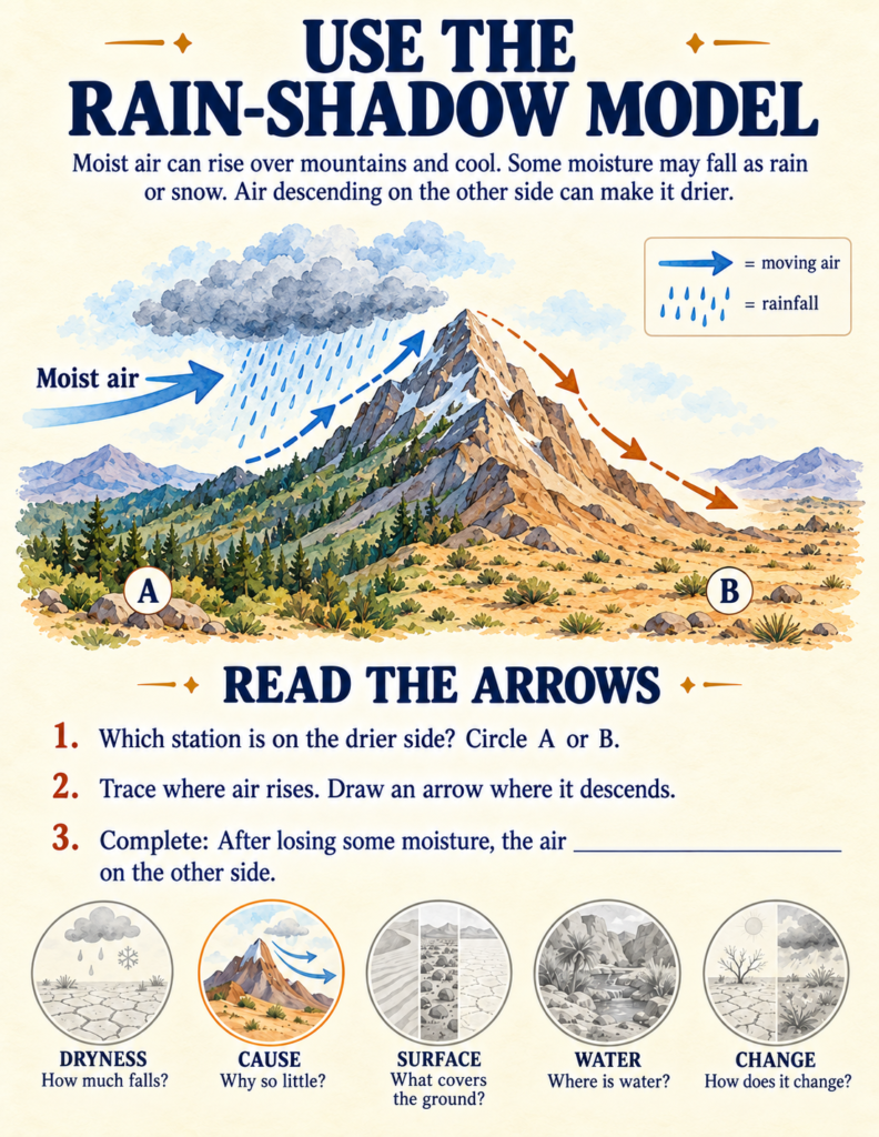
Atmospheric Mechanics: Why Deserts Lack Rain
Instead of asking children to memorize a list of famous dry places, the workbook investigates the physical mechanics that prevent clouds from producing rain:
- The Rain-Shadow Effect: When prevailing winds push moist air against a tall mountain range, the air is forced upward. As it rises, it cools and condenses, releasing rain or snow on the windward flank. By the time the air crests the summit and descends the opposite slope, it has lost its moisture, warming up and preventing cloud formation.
- Sinking Air Belts (The Sahara): In global circulation belts roughly between 15° and 35° latitude, massive atmospheric cells cause dry air to sink toward Earth’s surface. As this air descends, it compresses and warms up, making it virtually impossible for condensation to trigger rainstorms.
- Cold Ocean Currents (The Namib and Atacama): In coastal deserts, freezing oceanic water chills the lower marine air layer, creating a thermal inversion where warm air sits above cold air like a heavy lid. This prevents moist air from rising into storm clouds, producing dense coastal fog instead of rain.
In the Namib Desert, living organisms adapt to collect life-sustaining water directly from these creeping sea fogs without ever seeing a cloudburst. Studying how specialized beetles and reptiles time their behavioral patterns to catch condensed droplets mirrors the broader study of survival strategies detailed in our Animal Life Cycles Workbook, where students examine how animals develop unique physical structures to thrive within specialized habitats.

Botanical Rhythms: Surviving Between Rains
Arid flora must solve a fundamental engineering problem: surviving months or years without predictable moisture.
In the Sonoran Desert case file, students analyze real monthly rainfall data for Tucson, Arizona, discovering a bi-seasonal rhythm: winter rains followed by a severe spring dry spell, then sudden summer storms. Children compare watercolor field observations of an ocotillo shrub during a prolonged drought (bare, thorny branches) with its appearance just days after a storm (bursting with lush green leaves).

This dramatic structural shift illustrates plant hydraulics in action. In our Plant Life Cycle Workbook, students investigate how xylem vessels pull water upward to fuel leaf transpiration; here, young naturalists see the survival value of dropping foliage entirely to seal in internal moisture until the next downpour.
Deep Time: Was the Sahara Always Dry?
One of the most engaging aspects of the workbook is its treatment of deep geological history.
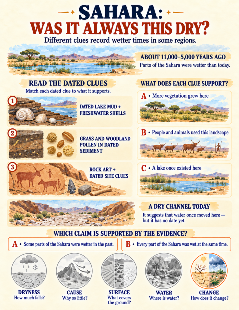
On the spread titled «Sahara: Was It Always This Dry?», students act as environmental forensic scientists, evaluating evidence from the «Green Sahara» period roughly 5,000 to 11,000 years ago:
- Dated Lake Mud & Freshwater Shells: Proving that permanent freshwater lakes and river basins once dotted what is now blowing sand.
- Fossil Grass and Woodland Pollen: Revealing that rolling savannas once covered areas that today receive less than 20 mm of rain.
- Ancient Rock Art: Showing that pastoral humans herded cattle, swam, and hunted large game across central North Africa.
This exploration of shifting prehistoric landscapes connects closely with the stratigraphic principles taught in our Dinosaur Workbook for Kids, where children learn that modern rocks and dry canyons preserve physical records of radically different past ecosystems.
Hidden Hydrogeology and Ancient Engineering
Arid lands are not devoid of water; water is simply stored underground or brought in from distant recharge areas:
- The Anatomy of an Oasis: Children trace rainwater falling on distant, permeable mountain slopes, watching it seep deep into bedrock fissures to travel subterranean miles as groundwater before emerging at a desert spring.
- The Qanat System: Students inspect ancient gravitational engineering, learning how human communities carved gently sloping subterranean tunnels into alluvial fans to carry water downhill to settlements without pumps.

Practical Integration for Home and Classroom
Because Deserts Around the World is self-contained with clear visual models, scaffolded evidence files, and a complete answer key, it fits effortlessly into a variety of educational settings:
- Homeschool Earth Science Block: Complete two pages daily over three weeks for a screen-free study that integrates meteorology, geography, and ecology.
- Small-Group Inquiry Stations: Laminate spreads like «Which Surface Model Fits?» (page 6) or «Repair a Broken Desert Map» (page 24) for partner deduction.
- Capstone STEM Modeling: Use the culminating «Build a Desert Model» mission (page 26) as an end-of-unit project where students synthesize air currents, rain shadow barriers, dune slopes, and groundwater springs onto a single landscape.
If you are looking for an educational resource that replaces cartoon dunes with genuine atmospheric physics, hydrological modeling, and climate evidence, Deserts Around the World gives your young scientist the tools to understand how Earth’s drylands truly function.