How to Teach World Capitals Through History and Geography (Without Flashcard Drills)
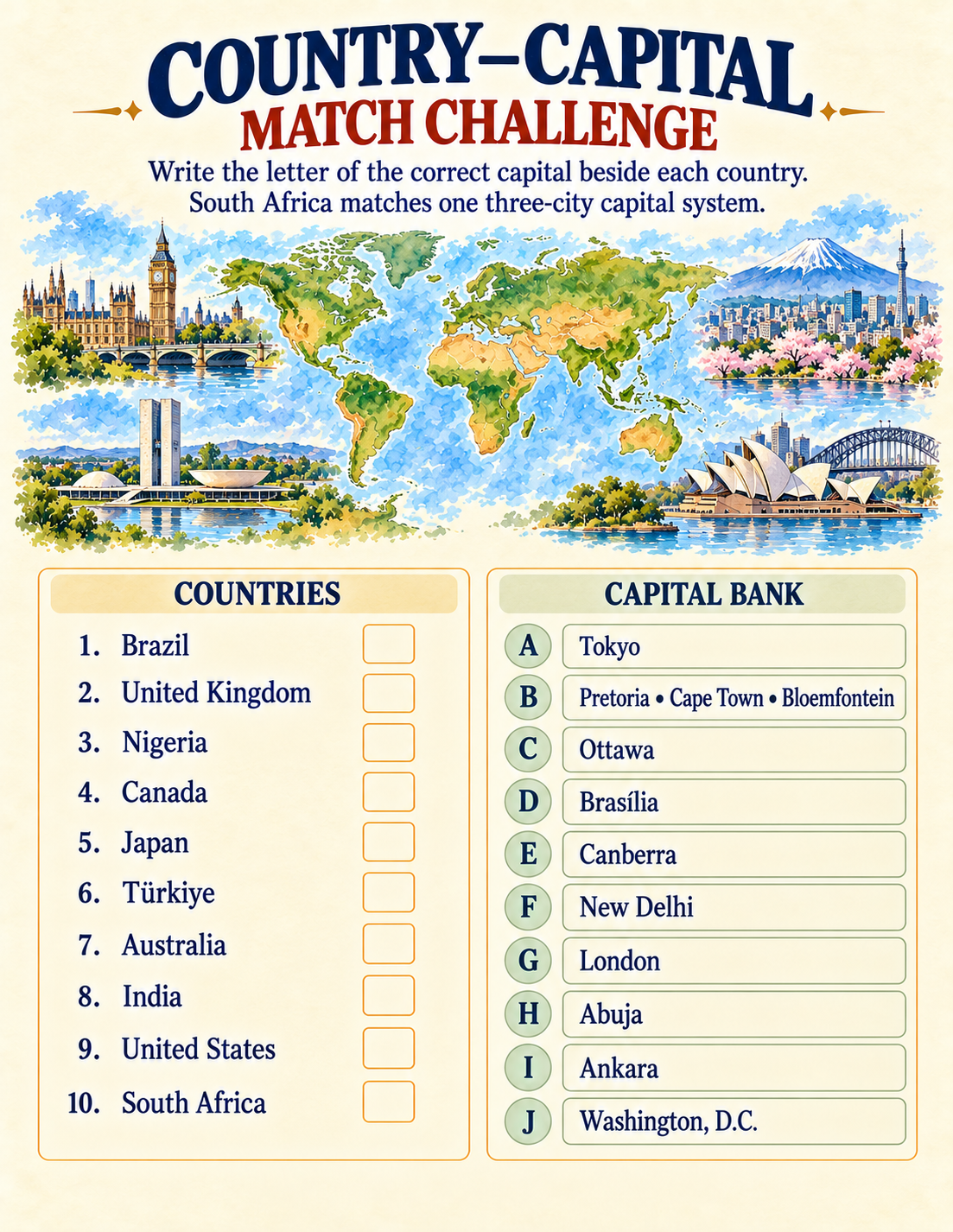
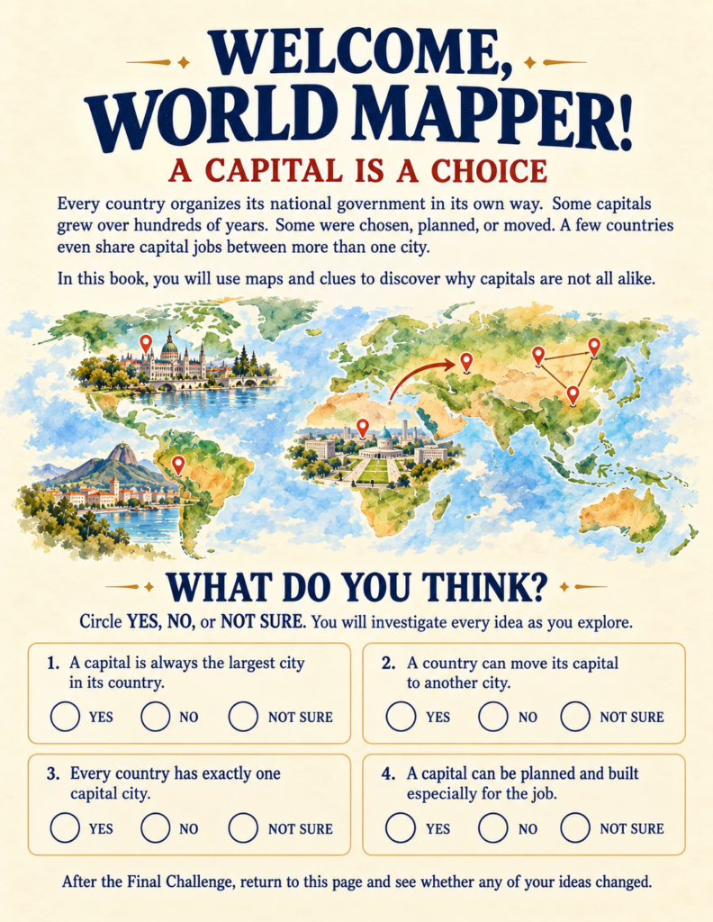
Ask a nine-year-old to name the capital of Australia, and you will almost certainly hear «Sydney.» Ask for the capital of Canada, Brazil, or Türkiye, and you will usually get Toronto, Rio de Janeiro, and Istanbul.
When geography instruction relies on matching games and isolated flashcards, children treat capital cities like arbitrary trivia answers to be memorized for a test and promptly forgotten. They end up assuming that a capital must naturally be the biggest, loudest, or most famous coastal metropolis in a nation.
Breaking out of that rote-learning rut requires shifting from passive recall to historical inquiry. A well-designed countries and capitals workbook should not merely ask children which city is the capital—it should challenge them to investigate why a particular city was designated to lead a nation in the first place.
Why Capital Cities Are Choices, Not Accidents
A capital city is rarely an accident of nature; it is a human political and geographic decision. Understanding how these cities earn their roles teaches elementary learners how physical landscapes, regional rivalries, trade arteries, and governance intersect.
When children learn why Washington, D.C. was carved out as a federal district along the Potomac rather than placed in an existing Northern financial center, they are learning about constitutional compromise.
When they examine why Nigeria shifted its administrative core from coastal Lagos to central Abuja, they are studying urban congestion and regional equity.
This approach transforms social studies into active problem-solving.
To help learners understand the broader physical geography behind these settlements—such as rivers, mountain ranges, and changing topography—introducing the Dynamic Earth Workbook Bundle | URL: https://tinyjoystudio.com/dynamic-earth-workbook-bundle/ helps ground geopolitical borders in real planetary landscapes.
A Five-Badge Framework for Geographic Reasoning
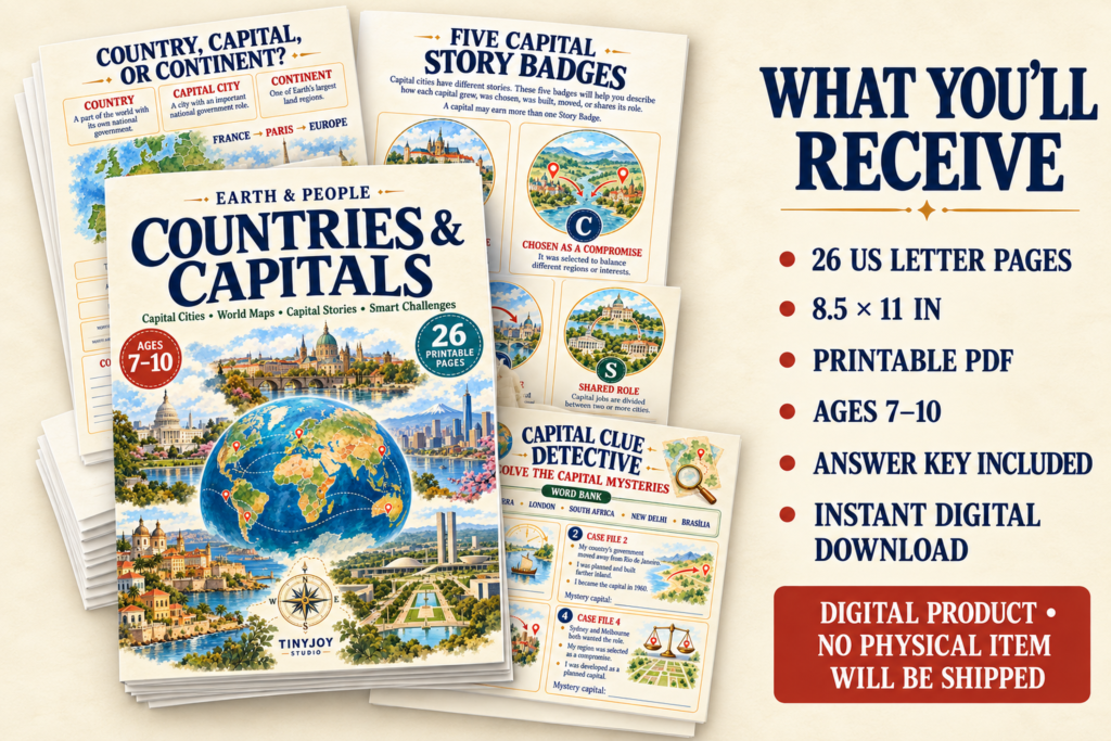
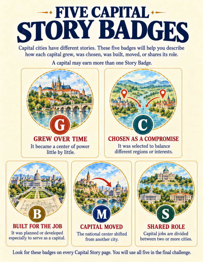
Instead of asking students to memorize an alphabetical table of 195 names, Earth & People: Countries & Capitals (a 26-page workbook designed for ages 7–10) organizes world geography around five analytical «Story Badges»:
- Grew Over Time (G): Cities like London that evolved organically along vital trade waterways over centuries, gradually absorbing royal and judicial seats.
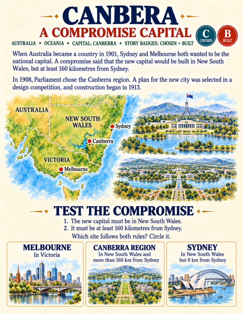
- Chosen as a Compromise (C): Sites selected specifically to resolve disputes between rival regions—such as Ottawa bridging English- and French-speaking Canada, or Canberra balancing Sydney and Melbourne.
- Built for the Job (B): Purpose-planned governmental districts constructed from architectural blueprints, including Washington, D.C., and New Delhi.
- Capital Moved (M): National relocations undertaken to spur interior development or escape coastal crowding, such as Brasília replacing Rio de Janeiro or Ankara replacing Istanbul.
- Shared Role (S): Intricate arrangements where governmental branches are intentionally divided, as seen across South Africa’s three capitals (Pretoria, Cape Town, and Bloemfontein).
Because children categorize each city through these conceptual badges, they learn to analyze cause and effect across history and urban planning.
Understanding ecosystems and biomes offers a crucial counterpart to this urban focus. Pairing urban history with Nature Workbooks for Kids shows students how climate and natural habitats heavily influenced where early civilizations chose to settle.
Unraveling Complex Political Geography
As children progress through the workbook’s ten featured capital narratives, they encounter nuances that standard worksheet packs deliberately avoid:
Sorting «Largest» from «Capital»
Children confront the common misconception that the most populous city always governs.
Through comparative card sorting, they distinguish between major urban powerhouses (like Toronto, Istanbul, and Lagos) and the actual governing capitals (Ottawa, Ankara, and Abuja).
Decoupling Official Capitals from Government Seats
The workbook introduces constitutional nuance through real-world case studies: Amsterdam serves as the official capital of the Netherlands, yet the Dutch parliament and monarchy convene in The Hague.
Similarly, Bolivia’s constitution names Sucre as its historic capital, while executive and legislative governance operates out of La Paz.
These distinctions encourage elementary children to ask nuanced questions: What purpose does this city serve? Who works there? What does the law say?
Tracing these cities across continents also connects directly to world exploration. When students pair their city studies with the Amazing Earth Adventures Workbook Bundle, they see how historic capitals interact with major waterways, coastal harbors, and mountain barriers.
From Map Analysis to Creative Town Planning
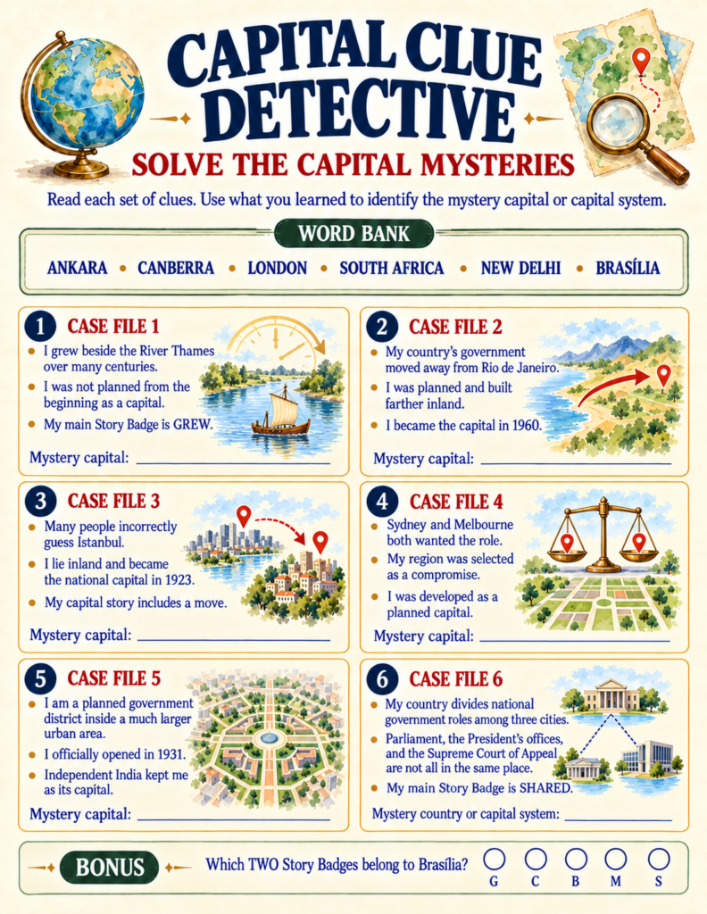
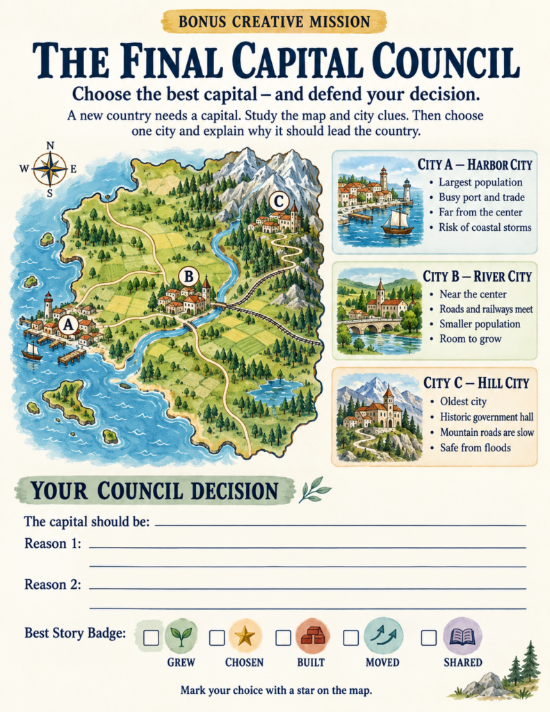
After solving case files in the «Capital Clue Detective» and charting locations on the unlabeled «World Capitals Map Challenge,» students reach the workbook’s capstone: The Final Capital Council.
Rather than finishing with a standard multiple-choice quiz, students act as national planners evaluating an imaginary terrain:
- City A (Harbor City): High population, active port trade, but vulnerable to coastal storms and far from the interior.
- City B (River City): Centrally located along rail and road crossroads, smaller population, but plenty of room to expand.
- City C (Hill City): Historic government seat, flood-safe, but constrained by slow mountain passages.
Children must weigh trade-offs, defend their chosen site with written arguments, and assign an appropriate Story Badge. In completing this simulation, they demonstrate the same strategic thinking used by real urban planners throughout history.
To extend this social studies inquiry into daily life, architecture, and human settlements, integrating the People and Places Workbook Bundle helps children explore how citizens live and work around the globe.
Practical Use in Homeschool and Classroom Settings
Because the activities in Countries & Capitals are self-paced and scaffolded with clear clue banks, parents and educators can seamlessly adapt them without extensive lesson planning:
- Homeschool Social Studies Unit: Run the book over two weeks, focusing on two capital stories per day.
- Morning Basket & Independent Work: The self-checking clue detective pages make ideal independent warm-ups.
- Geography Stations: Set up laminated map spreads for partner deduction and compass practice.
For families who want to deepen this journey through world navigation, pairing this study with the Explorer Skills Workbook Bundle provides direct practice with compass roses, coordinate grids, and time zones.
If you are ready to replace forgettable memorization drills with genuine historical reasoning and map literacy, Countries & Capitals gives your young explorer the tools to understand the world from the inside out.