School Is Not One Building: Teaching Human Geography Through Community Solutions
When elementary children are asked to draw a school, their sketches look remarkably uniform: a red brick exterior, rows of identical desks, a clock on the wall, and a loud electric bell. We often confuse the core mission of learning with the specific architectural objects we happen to see around us.
Yet across the globe, geography, seasonal weather, and community realities constantly demand different answers to the exact same goal. In the monsoon river deltas of Bangladesh, roads disappear under annual floodwaters, turning wooden boats into floating classrooms that travel directly to students. In the remote Australian Outback, classmates separated by hundreds of miles connect through radio waves, satellite internet, and mailed learning packets. In mountainous rural Colombia, one dedicated teacher guides children of five different ages inside a single room using self-paced study guides and collaborative peer rotations.
Teaching human geography through generic cultural trivia misses the profound ingenuity behind these adaptations. A thoughtfully sequenced schools around the world workbook does not present foreign classrooms as curious oddities; it trains students to examine the underlying systems—asking how geography shapes timetables, why routes require specific physical supports, and what trade-offs every community must navigate to help children learn.
Separating Learning Needs from Physical Features
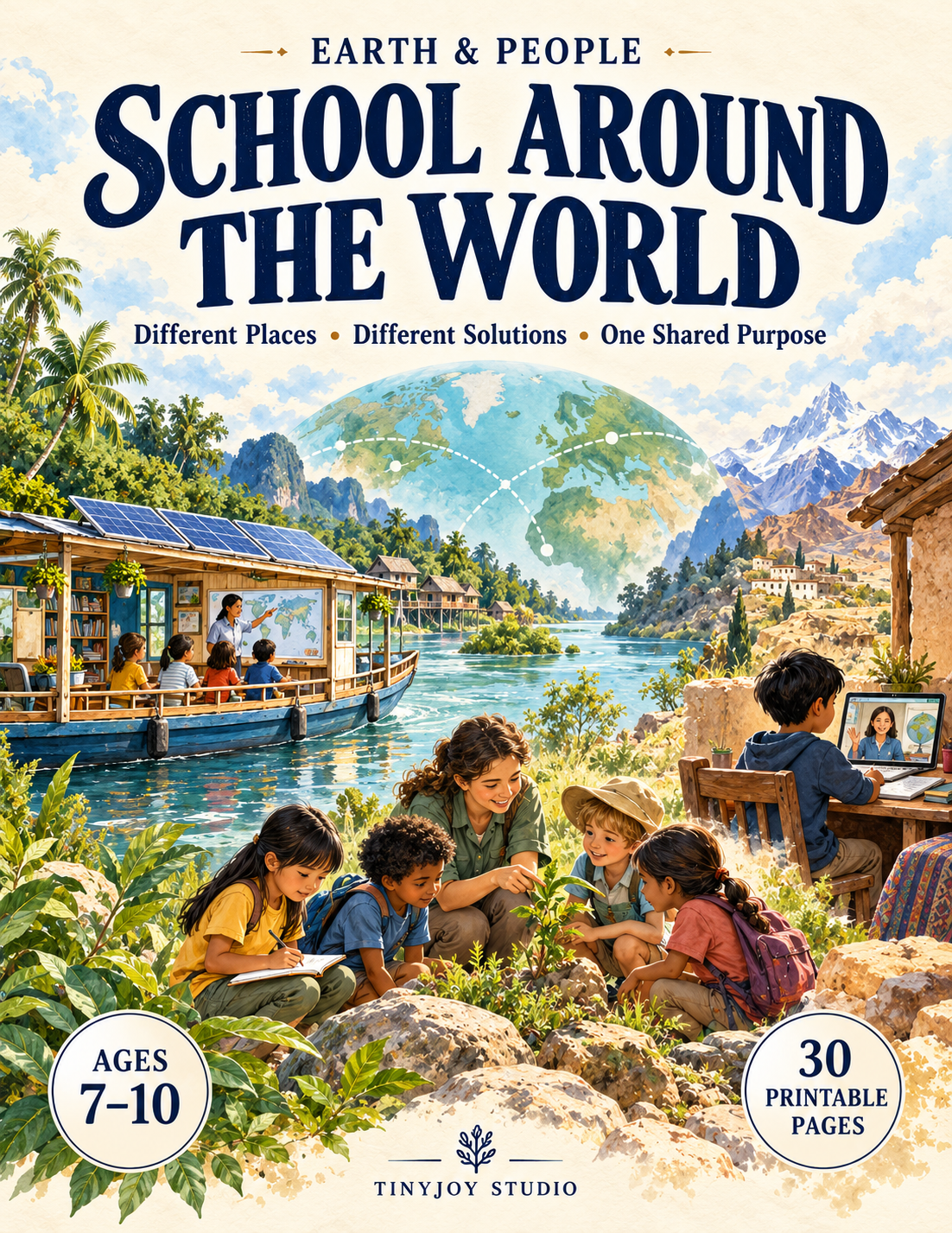
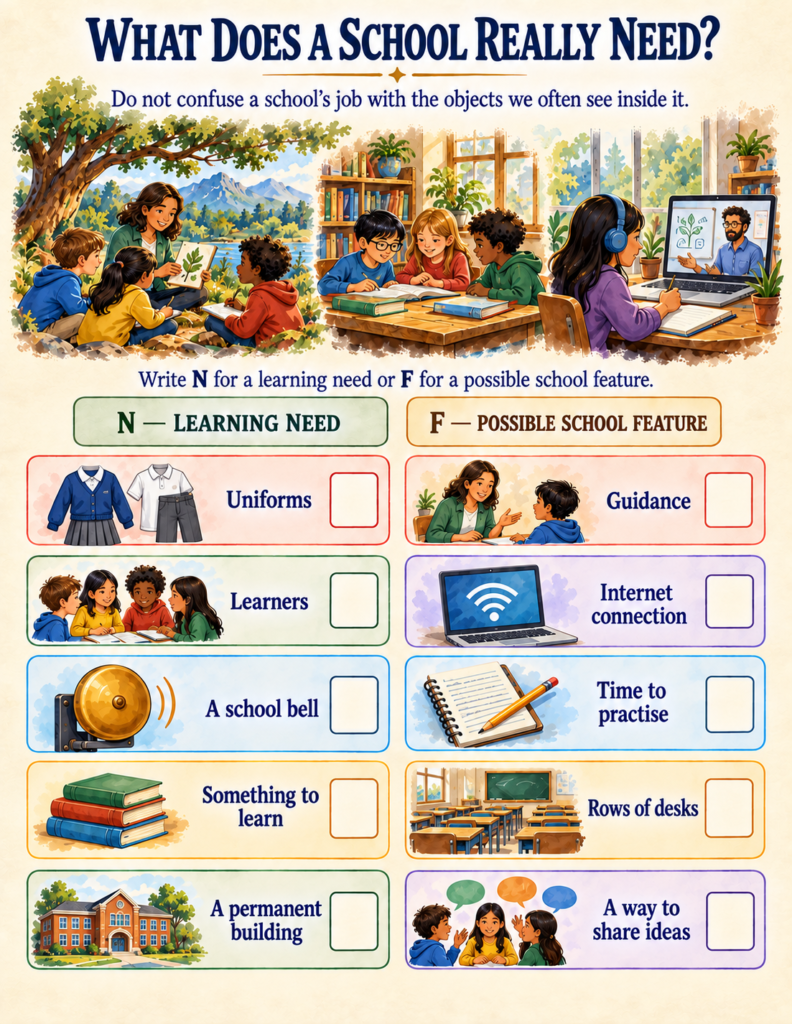
The central breakthrough in Earth & People: School Around the World (a 30-page printable unit designed for ages 7–10) happens on its very first exercise: «What Does a School Really Need?»
Students are presented with a series of cards and asked to sort them into Needs versus Features:
- Non-Negotiable Needs: Learners, guidance, something to learn, time to practice, and a way to share ideas.
- Contextual Features: A permanent brick building, rows of desks, uniforms, an electric bell, and a high-speed internet connection.
Once children realize that a school’s job is not tied to a specific piece of furniture or architecture, they become equipped to evaluate global classrooms with genuine analytical empathy rather than superficial comparison.
This distinction between core function and specialized physical structures is a universal principle across scientific disciplines. Just as botanical organisms develop specialized structures like xylem tubes or protective seed coats to handle specific environmental tasks—a concept explored in our review of the Plant Life Cycle Workbook — human communities design specialized learning environments that respond directly to local geography and climate.
The Journey Is Part of the System
Most curricula treat the school day as beginning when the morning bell rings. But in real life, learning can only take place if children can safely travel between home and the classroom.
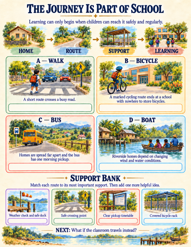
In the workbook’s «The Journey Is Part of School» spread, learners investigate how physical infrastructure determines educational access:
- A short walking path across a busy commuter road requires a marked, safe pedestrian crossing point.
- A dedicated bicycle path is useless if the destination lacks a covered, secure bicycle rack.
- Rural homes separated by vast distances depend on clear, predictable bus schedules.
- Riverside communities subject to seasonal tides require daily weather checks and sturdy, safe docks.
Understanding that an isolated change in one part of an environment creates ripples across an entire network helps elementary students develop mature systems thinking. Much like the interdependent canopy layers, humidity loops, and leaf litter cycles examined in our look at the Tropical Rainforest Workbook, a functioning school is an interconnected community web where transport, meals, local farmers, and teachers all support one another.
Seven Places, Seven Engineering Solutions
Rather than presenting an encyclopedic list of countries, School Around the World takes learners on an investigative expedition across seven contrasting global regions, using five analytical lenses: Place, Time, People, Language, and Support:
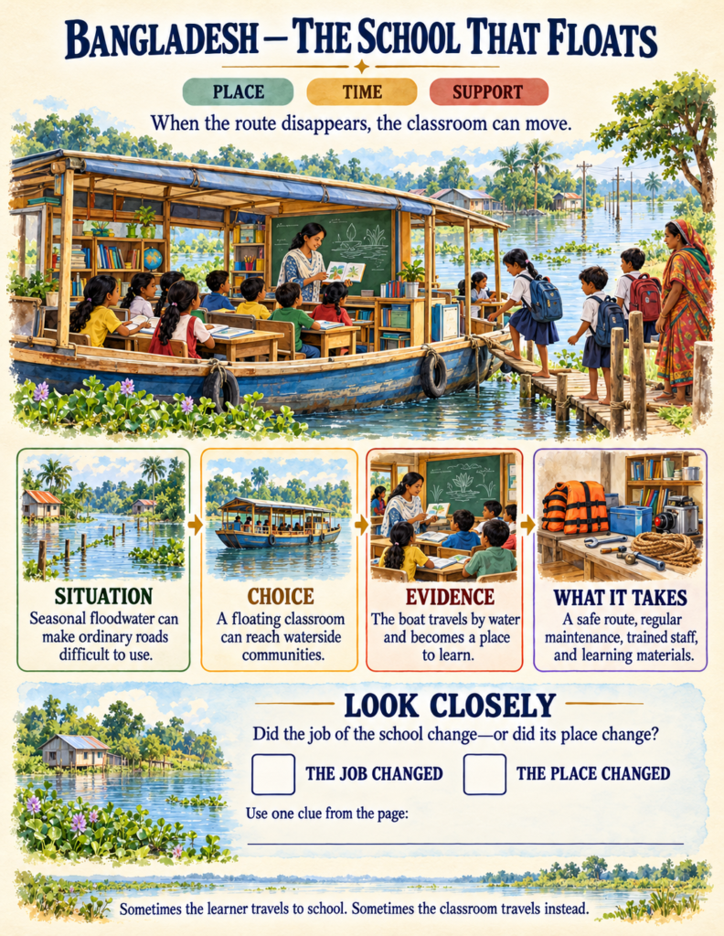
- Bangladesh (Floating Classrooms): When annual monsoon floods submerge roads, wooden boats equipped with libraries and solar panels become mobile classrooms that dock at local villages.
- Australia (The Outback Learning Loop): Distance transforms the route; lessons, completed assignments, and personalized teacher feedback travel hundreds of miles via radio, satellite, and post.
- Colombia (Escuela Nueva Multigrade Hubs): In rural mountain villages, one teacher coordinates several grade levels simultaneously by rotating groups through self-guided study modules, independent assignments, and teacher-led conferences.
- Japan (Shared Community Stewardship): Students and staff take joint responsibility for their shared space, rotating through age-appropriate daily care routines like wiping desks, sweeping floors, and sorting materials.
- West Africa (Home-Grown School Feeding): A balanced school meal connects learning with local agriculture; by purchasing produce from neighborhood farmers, schools boost student attendance, sustained energy, and community health.
- Aotearoa New Zealand & Nunavut, Canada (Community Language Plans): Schools integrate Indigenous languages (te reo Māori and Inuktut) into core subject instruction, reflecting community goals and revitalizing heritage.
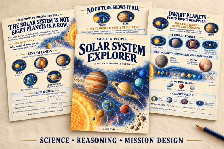
This analytical approach challenges children to realize that every model involves intentional design trade-offs. This mirrors how astronomers design spacecraft to match hostile environments—a principle highlighted in our guide to the Solar System Explorer Workbook —where an engineer selects a descent probe for Jupiter’s crushing gas atmosphere but a wheeled rover for Mars’ solid crust. In education, communities similarly tailor their learning structures to match their local terrain.
Avoiding «The Comparison Trap»
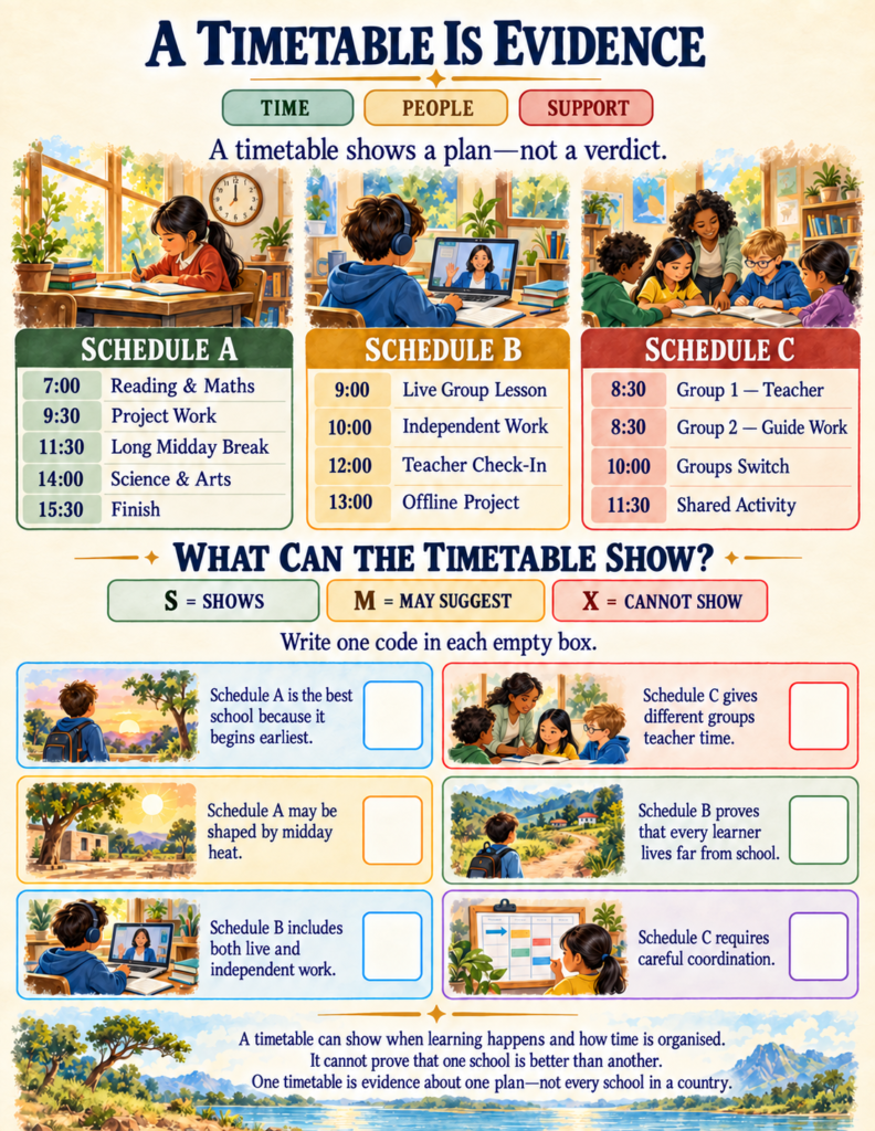
One of the greatest dangers in elementary social studies is ranking cultures: deciding that one school is «better» simply because it features expensive digital tablets, or that another is «worse» because its building is made of aged adobe or wood.
In «The Comparison Trap» and «Repair the School Guide» spreads, students audit sweeping, biased claims:
- The Superficial Claim: «School A is better because it has more tablets» or «School E is worse because its building is older.»
- The Missing Evidence: Are the digital devices dependable and actually useful for lessons? Has the older building passed safety inspections, and is it well-maintained and suited to the community climate?
- The Honest Rewrite: Students practice reframing biased judgments into fair, evidence-seeking inquiries: «What learning needs and local conditions shape how time and resources are organized here?»
By learning that different does not automatically mean better or worse, children develop intellectual humility and genuine geographical literacy.
From Map Analysis to System Architecture
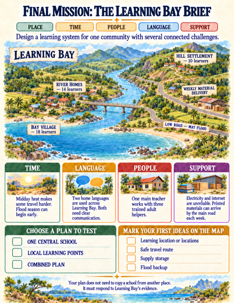
The workbook culminates in a multi-page simulation: The Learning Bay Mission.
Acting as educational planners, students evaluate a realistic regional briefing document:
- The Terrain: 10 learners in a hill settlement, 14 near river homes, and 18 in Bay Village.
- The Constraints: Midday heat makes afternoon walking dangerous, seasonal river floods submerge the low road in May, electrical connections are intermittent, and families speak two distinct home languages.
- The Resources: One certified teacher, three trained adult community assistants, and weekly delivery trucks carrying printed workbooks along the main road.
Learners must sketch the learning locations, establish schedules, allocate teacher and assistant duties, choose backup protocols, and defend three critical choices using concrete data. Finally, they subject their plan to a «Stress Test»—what happens when floodwaters rise a week earlier than expected?
Simple Implementation for Homeschool and Classroom
Because School Around the World provides embedded case files, visual organizers, and a thorough answer key, it requires zero specialized preparation:
- Homeschool Human Geography Block: Complete two pages daily over three weeks for a rich, screen-free social studies curriculum.
- Classroom Inquiry Stations: Print individual case studies—such as the Outback radio school or Japan’s cleaning routine—for collaborative small-group discussions.
- Community Design Project: Use the Learning Bay planning brief as a cross-curricular capstone integrating geography, mathematics, civics, and critical reading.
If you are ready to replace superficial costume-and-flag worksheets with authentic human geography, real problem-solving, and a deep appreciation for how communities everywhere make learning work, School Around the World gives your young explorer the tools to see our shared world through fresh eyes.